Tankar 63º 57,0´N 22º 51,0´E
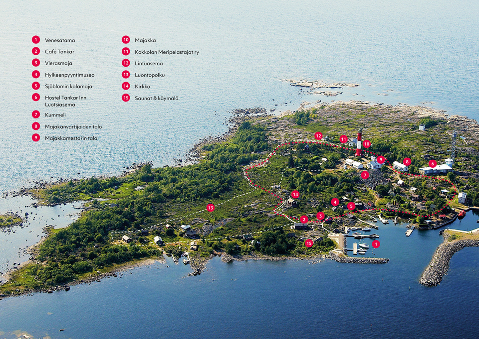
The island of Tankar is situated in the outer archipelago in the south of the Bay of Bothnia, approximately 15 km north-west of Kokkola harbour. In the 13th century, the island raised out of the sea as a result of geological uplift. For centuries the desolate island acted as a base for seal hunters and fishermen. It later became an important landmark for seafarers.
Today Tankar is a versatile place to visit, offering the traveller unforgettable nature experiences and excerpts from old archipelago life. During the summer there is regular scheduled traffic to the island from Kokkola Meripuisto.
There is no road connection to the island, but there is a variety of choices for boat connections available.